


Midvale 7 Voting District, Washington County, Idaho
About
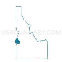
Outline

Summary
| Unique Area Identifier | 564449 |
| Name | Midvale 7 Voting District |
| County | Washington County |
| State | Idaho |
| Area (square miles) | 728.21 |
| Land Area (square miles) | 716.53 |
| Water Area (square miles) | 11.68 |
| % of Land Area | 98.40 |
| % of Water Area | 1.60 |
| Latitude of the Internal Point | 44.43708710 |
| Longtitude of the Internal Point | -116.69004970 |
Maps


Graphs
Select a template below for downloading or customizing gragh for Midvale 7 Voting District, Washington County, Idaho


Neighbors
Neighoring Voting District (by Name) Neighboring Voting District on the Map
- Voting District 003001, Adams County, ID
- Voting District 003004, Adams County, ID
- Voting District 075010, Payette County, ID
- Bench Voting District, Gem County, ID
- Cambridge 8 Voting District, Washington County, ID
- East Weiser 6 Voting District, Washington County, ID
- Mineral 11 Voting District, Washington County, ID
- Ola Voting District, Gem County, ID
- Sunnyside 10 Voting District, Washington County, ID
Top 10 Neighboring County Subdivision (by Population) Neighboring County Subdivision on the Map
- Payette CCD, Payette County, ID (9,837)
- Weiser CCD, Washington County, ID (8,543)
- Council CCD, Adams County, ID (2,227)
- Sweet CCD, Gem County, ID (1,303)
- Halfway CCD, Baker County, OR (1,084)
- Cambridge CCD, Washington County, ID (935)
- Eagle Valley CCD, Baker County, OR (840)
- Midvale CCD, Washington County, ID (720)
Top 10 Neighboring Place (by Population) Neighboring Place on the Map
Top 10 Neighboring Unified School District (by Population) Neighboring Unified School District on the Map
- Emmett Independent School District 221, ID (16,719)
- Payette Joint School District 371, ID (9,962)
- Weiser School District 431, ID (8,470)
- Council School District 13, ID (2,025)
- Pine-Eagle School District 61, OR (1,681)
- Cambridge Joint School District 432, ID (1,147)
- Midvale School District 433, ID (664)
- Huntington School District 16J, OR (539)
Top 10 Neighboring State Legislative District Lower Chamber (by Population) Neighboring State Legislative District Lower Chamber on the Map
- State House District 60, OR (55,458)
- State House District 11, ID (51,062)
- State House District 9, ID (38,220)
Top 10 Neighboring State Legislative District Upper Chamber (by Population) Neighboring State Legislative District Upper Chamber on the Map
- State Senate District 30, OR (115,913)
- State Senate District 11, ID (51,062)
- State Senate District 9, ID (38,220)
Top 10 Neighboring 111th Congressional District (by Population) Neighboring 111th Congressional District on the Map
Top 10 Neighboring Census Tract (by Population) Neighboring Census Tract on the Map
- Census Tract 9601, Payette County, ID (6,394)
- Census Tract 9703, Washington County, ID (4,664)
- Census Tract 9601, Gem County, ID (4,390)
- Census Tract 9702, Washington County, ID (3,879)
- Census Tract 9502, Adams County, ID (2,227)
- Census Tract 9506, Baker County, OR (1,924)
- Census Tract 9701, Washington County, ID (1,655)
Top 10 Neighboring 5-Digit ZIP Code Tabulation Area (by Population) Neighboring 5-Digit ZIP Code Tabulation Area on the Map
- 83661, ID (9,881)
- 83672, ID (8,583)
- 83612, ID (1,925)
- 83610, ID (946)
- 83645, ID (636)
- 97870, OR (573)
- 97907, OR (560)
- 83632, ID (214)
- 83657, ID (174)
- 97840, OR (98)